Showing posts with label Pedestrian Friendly. Show all posts

Monday, January 28, 2013

"I Know Engineers...They Love to Change Things"

English: A diagram of a diverging diamond inte...
English: A diagram of a diverging diamond interchange, showing how the traffic flows. Apparently, the Dept. of Transportation in the state of Missouri had too much money this year and hired some kids to do the drawings. If people would simply pay attention to their driving, instead of treating their vehicle like a phone booth/restaurant, ridiculous designs like this wouldn't be part of today's roads Svenska: En bild på en divergernade diamantkorsning som visar hur tafiken rör sig. (Photo credit: Wikipedia)
For those too young to remember the quote from the title of this entry, it is from Star Trek: The Motion Picture and from Dr. McCoy and I thought it was perfect for this entry.

I came across the video below on the Portland Transport site and thought it was something that had to be shared. The Utah Department of Transportation installed one of these intersections at 2100 South Expressway and Bangerter Highway in West Valley.

The diagram on the right gives you the basics of what these types of intersections are supposed to do. I have to say the first time I approached the one on Bangerter Highway it was really confusing especially since it was dark and snowing at the time.

There was also several drivers almost taken out at the intersection by a semi that seemed to be even more confused that the average driver over how to drive this thing.

While the one in the video has "token" pedestrian and cycling access the Utah one does not but then again Bangerter and the 2100 South Expressway is not designed for pedestrians.


Besides this diverging diamond intersection, UDOT has also been busy turning traffic lanes on 5400 South into reversible lanes. In addition they also did a continuous flow intersection treatment at Redwood and 5400 South that I will discuss in the future.
Enhanced by Zemanta

Friday, March 18, 2011

Pedestrian Dead Zones

A TRAX train passing the Frank E. Moss Federal...Image via Wikipedia

Just because you build nice wide sidewalks and create a barrier between cars and pedestrians (such as trees) does not mean you will create an environment that conducive to pedestrian activity. To create pedestrian activity you need to have someplace to walk to but also reduce the number of barriers that exist to actually using those sidewalks to get somewhere.

Despite its very long blocks, there is some good pedestrian activity in downtown Salt Lake City from North Temple to about 350 South. If you travel any farther south than that you will see a remarkable decrease in the number of pedestrians. There is several causes of this drop off in pedestrian activity and I will cover some of the major ones in this posting.

Since Main Street is home to the TRAX light rail line I will start off at the corner of 400 South and Main. On the northwest corner of the intersection with have a court house. Court houses tend not to foster pedestrian activity because they are a single point destination, in other words people may go to the court house but that is the only reason they head there.

They are currently expanding the court house to take up most of the block from Main Street to West Temple. This will create a large barrier to pedestrian activity in the area. With court houses becoming even more fortified these days this makes court houses even more unfriendly toward pedestrian activity these days.

Here is a picture of the current court house looking north:


Here is a picture looking south diagonally from corner of 400 South and Main toward the corner of 500 South and West Temple.


Does this look like a thriving pedestrian and transit friendly downtown area or does it look like a parking lot of a suburban office park? This block of parking is made worse because of Salt Lake City's extremely long blocks. To the left of the picture is the Court House TRAX station and on the next block at State Street is another court house.

There is apparently a long story involving this parking lot barrier that covers the block between 400 South, 500 South, Main and West Temple. Despite all the opportunities that exist for development of this block with a TRAX station at the front door this lot will most likely stay as it is for the foreseeable future.

Once you walk pass the parking lot you face a new barrier for pedestrians-the 500 South and 600 South speedways to Interstate 15:


However, it is not three and four lanes of speeding cars that create a barrier to creating an effective pedestrian environment, it is the development that has occurred along the two streets. Because 500 South and 600 South are the two primary access streets to Interstate 15, the area along the two streets have become lodging row.

You would think that lodging facilities would want to foster pedestrian activity in the area but instead most lodging facilities are designed on two principles:

1. Everyone will arrive by car so there is no need to create effective pedestrian access points.
2. Especially if the lodging facility has on sight restaurants, the goal is to ensure the people staying at the facility only use their restaurants or have to get in their car and try to find parking if they want to eat somewhere else.

If you look at the picture above, you will notice that there is no pedestrian access point from the building in the picture to street level. This building is the Little America Hotel that covers all of the block with its sister property the Grand America Hotel taking up half of the block on the far side of Main Street (there is some irony that the Grand America was home to Railvolution back in 2005).

The next two pictures show the main entrance of both hotels on Main Street. While there is some pedestrian access to both hotels it is design more to foster getting guests between the two facilities than actually create any pedestrian activity on Main Street.


To be fair, the Little America does have a pedestrian entrance to its restaurant on Main Street about halfway between its main entrance and 500 South but it appears that there is few people that use it since pedestrian traffic on this section of main street is non-existent.

South of 600 South you have there is some areas of abandoned or barely used businesses and past 700 South you encounter several car dealerships including the Mark Miller Toyota Sprawl lot that completely kills most pedestrian activity in this neighborhood.

Heading back north we move one block west to West Temple and you have the only access point to the Little America from West Temple and as you can see from the picture it is not exactly pedestrian friendly:


To be fair to the Little America/Grand America hotels, they are not the only culprits as the Embassy Suites at 600 South and West Temple shows with its very small sidewalk providing the only pedestrian access to the hotel:


In fact I all of the hotels except for Motel 6, had very poor to no pedestrian access points to the hotel. This next photo is back at 500 South looking south toward 600 South with the Little America on the left. As you can see the east side of West Temple has the right elements for pedestrians, there is just too many barriers to using it.


Finally you look back toward downtown, so close yet so far away.


You can build sidewalks and put trees in to create an environment that should foster more pedestrian activity, but if development or the lack of it and street design creates barriers to pedestrians all sidewalks in the world will not encourage people to use them.


Enhanced by Zemanta

Thursday, November 11, 2010

Perils for Pedestrians Video

Since I was in Portland last month for Railvolution, I thought this Perils for Pedestrian video was appropriate since it covers the Portland area.

Tuesday, October 26, 2010

Safeway Store


Here is a photo I took while in Portland last week.

This is one of three stores that Safeway has opened that service the urban area.

While some stores have a difficult with the concept of a pedestrian friendly store, it is nice to see that one chain has been making them work.

I shopped at this one and the one in the Pearl District along with checking out some locally owned competition.


Enhanced by Zemanta

Wednesday, September 15, 2010

Using Redevelopment and Bus Improvements in a Corridor

Grigio MetroImage by Steven Vance via Flickr
One of the problems we face here in Utah is the lack of regional planning. While we do have the Wasatch Front Regional Council and MAG, they concentrate primarily on highways and the cities still do their own planning. Of course the likely hood of having an effect regional planning organization in Utah is nil considering the political bent of many in the region.

However, I decided to do a what if scenerio. What if we could take a bus route, look at all aspects of that bus route including land use and direct land use and transit planning to improve the route and the neighborhoods it travels through.

Here is the criteria I used to decide which route to focus on:

1. Had to be a frequent service route to provide enough service to be attractive to choice riders.

2. To create better dynamics, the route had to connect with as many other frequent service routes as possible (which eliminated routes such as 35 MAX/35).

3. The route had to have either vacant land or an area in decline in order to optimize the redevelopment opportunities to create transit friendly development.

I decided to focus on the 209 for these reasons:

1. Yes it is a frequent service line

2. The route not only has a large number of connects in downtown but it also connects with many frequent service lines along its route including TRAX, 21, 33, 39 and 45.

3. The area between 2100 South and 4500 south has areas that are in decline and and have opportunities for redevelopment into more pedestrian, transit, and bike friendly neighborhoods.

So lets start off with the basics and look at the route itself.

The route travels from downtown to the Fashion Place West TRAX station via South Temple, 900 East and Winchester.

As I have mentioned many times before, it makes more since to improve bus routes such as the 209 than to do Badly Repackaged Transit which is not just like rail except cheaper which it is not.

Signal Prioritization would be a good step to improve performance but like planning with each jurisdiction having control over their traffic lights, it makes doing it difficult. While the MTA in Los Angeles has been successful with signal prioritization in the city of LA, there is many small cities that Metro Rapid lines pass through that have not implemented them slowing the routes done.

Next up would be to consolidate bus stops that are located too close together and design the remaining bus stops to take advantage of low floor buses by making the curbs equal to the stop on the buses. This along with doing away with the fare free zone allowing buses to board from the front door in both directions will allow the bus to make the trip faster.

A longer term goal would be to change the south end of the line. Instead of traveling on Winchester, the buses should continue south along 900 East. The current portion along Winchester should be replaced by an extension of route 62 from the Fashion Place West TRAX station to the Cottonwood Corporate center and on to the park n' ride lot on Wasatch. This would be a long range goal that is not going happen in the near term.

The 209 should be split into two routes the 208 and the 209 with the 208 traveling 900 East/700 East to 8000 South to State Street to 7720 South and over to the Midvale Center TRAX station. The 209 would turn southeast along South Union and Creek Road like the old 44 then continue on to 3500 South and Bengal Blvd. The only issue would be the snobby NIMBY's along the eastern side of Creek Road would probably oppose having a bus in their neighborhood. Of course these ideas are years away as we have to build ridership on the existing system to make them economically feasible.

The last bus related improvement along the route would be to add bus stop shelters at major stops along the route. However, they need to be designed to fit into the neighborhood and not be the standard ugly glass and metal shelters many transit systems use.

The next step would be redevelopment of several areas along the route that will increase density in important spots which will also increase ridership not only for the 209 but the other frequent service lines that cross the 209.

First up is the intersection of 400 South and 900 East where the University Line TRAX station is located. All four corners of this intersection could be redeveloped with community stores and housing above. The housing could be tailored to the older students at the U or to downtown workers.

Next up would be the Sugarhouse area. Right now the corners at 2100 South are dominated by auto designed stores especially the new Kroger store on the southeast corner (yes I know it says Smith's, but Smith's largely exists in name only it is a Kroger store). There is plenty of possibilities to create a pedestrian, and bike friendly corridor from 2100 South down to I-80 where the new recreational trail will go through. This should be part of the Sugarhouse plan that includes the streetcar connections once it is built.

The intersections of 3300 South, 3900 South and 4500 South are also ripe for redevelopment that should include transit, pedestrian and bike friendly uses that include apartments, homes, and neighborhood retail. The neighborhoods between the intersections would largely remain untouched and still have better bus service.

The biggest obstacle in this part of the corridor would be the Kroger store at 4500 South and 900 East since Kroger has shown to be very anti-pedestrian friendly. They want to the store this way or the highway and are willing to blackmail with the threat of leaving the area to get their way. To top it all off, the center is owned by the Boyer Group which has not shown any friendliness to transit friendly designs.

By making improvements to the bus route and redeveloping under performing real estate you will not only create a better bus line, you will improving the community and building a better base for ridership on UTA lines. You will also create more vibrant community that will be a discouragement to the gangs that seem to be taking over that section of the community.


Enhanced by Zemanta

Friday, August 13, 2010

Perils for Pedestrian Video

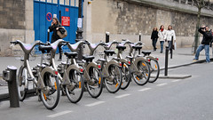
Paris Bicycle for rentImage by Serge Melki via Flickr
I has been a few months since I posted one of these videos so I decided to was time.

This episode is from Paris, France. It is interesting to see the city of Paris which we think as a more pedestrian and transit friendly city still has its own problems that create problems for pedestrians.

Also some great information on the bicycle sharing program that has been going on in Paris. Like anything it has its troubles but overall the program has been working well. There is also some good comments on the usually comments you get when you attempt to take away parking.

The video also shows you how simple the bicycle sharing program is.

Perils For Pedestrians Paris

Enhanced by Zemanta

Saturday, June 05, 2010

Pedestrian Friendly??

During the elections last year, Holladay City Councilperson Pat Pignanelli promoted that she had made walking and cycling easier in the area by getting a sidewalk put in near a park and also said that bicycle lanes were making it safer for kids to get to school on Spring Lane.

So is the area more pedestrian friendly now? Or is it more propaganda for a politician trying to get elected but is doing little make the community less pedestrian hostile?

I decided to take a walk with the area and take some pictures of the good, bad and very ugly when it comes to pedestrian friendly in the Holladay area.

We will actually start this journey in Murray at 900 East and the Van Winkle Superspeedway for bad drivers, I mean Van Winkle Expressway. This first photo is looking east across 900 East. As a pedestrian not only are you faced with trying to cross a wide street but you face doing it in a non-existent crosswalk and deal with drivers turning right who rarely look for pedestrians.

In addition the Beehive Academy is just to the left out of the picture so there is a large number of children who have to navigate this area.


Next we start our walk down Murray-Holladay Road which looks very attractive with a nice grassy area and trees between the pedestrian and the speeding vehicles. While the speed limit is 35 mph down the section of Murray-Holladay from Van Winkle to 1300 East, many drivers travel far beyond that speed.

As you can see we are approaching a problem in the sidewalk.


In front of an office building, there is a jog in the sidewalk. While this may be no problem for many people, for anyone who has a disability especially those that are in wheelchairs, this creates a hazard they have to navigate.


Getting closer to 1300 East we continue to have a barrier between the pedestrian the street although the sidewalk is narrow and so is the barrier. In addition you have several homes that have large walls put up that create another feeling of unfriendliness for the pedestrian.


As you can see from the next photo after you cross 1300 East the barrier disappears and you are right next to speeding traffic. As can be seen from the photo Murray Holladay can be a very busy road and this photo was taken during a quiet part of the day.


Now we enter the area where Pat Pignanelli proudly proclaimed that she put in a sidewalk so it is more pedestrian friendly. First you encounter this hill with speeding vehicles including trucks and buses to your left and this slope to your right. During winter it would easy to slip and fall down the hill and if you needed to make a quick move you would have no choice but to dive down the rocky slope.

As you get closer to a park, the road flattens out but then you have this wall that creates another barrier and despite the presence of the sidewalk, there is nothing between you and speeding cars and trucks. Of course when I took these photos it had to be one of the most quiet times I have ever seen on Murray-Holladay Road, but you can get an impression on how bad the situation could be with more traffic.


Once again you have another spot where the pedestrian is forced to alter course.

Here is another shot that shows that you may put in a sidewalk but it does not make it pedestrian friendly.

Now we turn off of Murray-Holladay Road and on to 1665 East that becomes Kings Row Driver.

At the corner of 1665 East and Murray Holladay sits a popular park. However, apparently not popular enough to put in a sidewalk.


Now as it becomes Kings Row, the road is more pedestrian friendly but don't let the speed bumps fool you. They are not there to make things better for pedestrians but to slow down people who would speed through the neighborhood at high speed because it goes all the way to 1300 East.


If fact here is the intersection of Kings Row and 1645 East. As you can see there is speed bumps but no crosswalks to make the area more pedestrian friendly.


Now here is a view looking down Fieldcrest Lane. While the sidewalks are a little too narrow, a pedestrian feels more at ease down this street since cars are going slower and there is real sidewalks and medians between the sidewalk and the automobile lanes. However, you only go a couple of blocks and all sidewalks disappear.


The next photo shows what happens when you are not careful when planting trees. If a developer is just trying to build n' burn they will quickly plant trees and move on. If the trees are not buried far enough in the ground the roots will spread out and damage the sidewalk making it unsafe for pedestrians and eventually the trees are cut down to stop the damage.

Further west on Kings Row there is more speed bumps but you also have the ball field for St. Vincent De Paul Catholic School. Here there is a cross walk with a speed bump. Hopefully this slows down the drivers so that the children are in less danger than they would other wise be.


However, just up the road at 1300 East you have an extremely dangerous intersection. Despite the school being right behind me in the photo, there is no crosswalks marked at this intersection. Many times I have seen people almost hit because people making left and right turns onto Kings Row from 1300 East will not look for pedestrians.

In addition Kings Row has a slight summit then comes down to 1300 East. People often get passed the last speed bump (show above) then speed toward 1300 East and will often go partially into the intersection before they stop.


Here is a car making a right turn onto Kings Row. While these people did, often times drivers will not look for pedestrians and will nearly hit people trying to cross the road.

Next down at 1300 East and Spring Lane we have another problem intersection. While this one has had a light for about 5 years now, people turning off of 1300 East have this wall to the right and will often not slow down to check for pedestrians are in the crosswalk or trying to cross. In addition right turning drivers have to worry about something rear ending them because people are too impatient to wait for a car to make the right turn onto Spring Lane.


Finally we have Spring Lane itself. Here we have another one of those "feel good" projects that do little to increase pedestrian (and in this case) bike safety. What was the parking lanes along Spring Lanes have been stripped as bicycle lanes.

However while not present in the photo, there is often cars parked in the lanes which requires bicycles to go into traffic. In addition there many parts of Spring Lane have no sidewalks so both pedestrians and bicycles are forced into traffic.


As can be seen from these photos, just because you put down some concrete for a sidewalk does not make an area pedestrian friendly. Our communities need to be more pedestrian and bicycle friendly in order to make them more livable. In addition it is hard to get people to try transit when they have to risk their lives just getting to the bus stop.

It is not the responsibility of the transit system to make it easier to get to the bus stop but the city or jurisdiction. They need to ensure that transit riders can get to the bus stop and ride. This will not only benefit transit but the city as well.
Reblog this post [with Zemanta]

Wednesday, January 28, 2009

Perils for Pedestrian Video

I haven't posted one of these in a couple of months so here is one covering events happening in Maryland including pedestrian facilities on new bridges. There is also a section talking about the proposed Purple line in the Washington DC Area.

Monday, December 08, 2008

Senior Citizens, Driving, and Development

:en:Category:Images of Pasadena, CaliforniaImage via Wikipedia

Every time there is an accident involving a senior citizen, there is always a question of should they have had a license? The worst accident I ever had was when a senior citizen got confused in an intersection and turned in front of on coming traffic which happened to be me. Despite getting behind the wheel of stock cars and racing, I was never injured but this accident not only put me out of work for a month, I couldn’t get back behind the wheel of a race car again.


Senior citizens have become the biggest victims of 70 years of auto centric development. The only way most senior citizens can get their basic needs is to continue driving despite impairments, depend on family members, or move into a retirement home.


When I was growing up in Pasadena, California my mother managed several apartment complexes along a street block. More than 70% of the residents were widows or widowers from 60 to 80 years old. Most of them did not have a car because they didn’t need one. There was a small grocery store on the cross street to the south and major doctors offices on the cross street to the north. The RTD (now Metro) ran regular bus service along the cross street to the south. Other major services were very close by.


Contrast that with the situation my in-laws are in. My father in-law is blind in one eye and cannot drive at night. My mother in-law has to do the driving at night but her driving skills have been compromised with age. The problem is, because they live in an area were they have to drive just to by groceries or go to the doctor, they continue to drive.


Many senior citizens feel that their lives are over without their cars because there is not alternative for them. This is largely what has fueled the market for retirement homes. Because these places are expensive, many senior citizens wait until it’s almost too late before deciding to move into one. In addition much like a mall (or Gateway), a retirement home is design to make the person dependent on the facility and not make it easy to access anything else. The residents can either drive if they are still capable or ride the facility provided vans to different stores.

In addition many of these facilities are placed in areas were it is convenient for family members to come visit grandma on Sunday, but not convenient for the residents to use public transportation or to walk to neighborhood stores.


The ones at 11400 South and 700 East are a perfect example of this. There is not public transportation available, nothing is in walking distance so the residents either have to drive or more likely is dependent on the facility provided vans.


After my father passed away my mother ended up in a situation very much like her former residents in California. She lived in a section of Spokane were she could walk to the store (or they would deliver), walk to a café, dry cleaners, doctors offices and other small stores, or had regular bus service from her front door to downtown. Despite not having a car she was able to live on her own until a stroke caused some major health issues and she had to be put in a nursing home.


Which situation would you rather be in? Forced to drive or go into a retirement home, or have the freedom to live on your own and not have to depend on others? Personally, I prefer the latter.

Reblog this post [with Zemanta]

Monday, November 03, 2008

Perils for Pedestrian Video

Here is another perils for Pedestrian Video.

This video covers the complete streets legislation that has been blogged about over the last few months. The video also features the city of Davis, California which was the first to reach platinum level with the League of America Bicyclists.


Saturday, October 18, 2008

Blog Entries of Note...

East Atlanta: pedestrian friendlyImage by Amber Rhea via FlickrFrom the Mobilizing the Region Blog:

Where the Sidewalk Continues…

In September 2006, NJ Gov. Jon Corzine launched a five-year, $74 million statewide pedestrian safety initiative that included money for several NJDOT pedestrian safety programs, traffic calming infrastructure, “traffic-stat” technology, and increased inter-agency coordination. Two years in, the results are visible around the state.

This is what we need in Utah, a program to improve pedestrian safety.

From the Xing Columbus Blog:

62 New Bike Racks Installed in Past Three Months

Columbus, Ohio has installed a large number of bike racks around their city recently. One of the problems many bicyclist face is the lack of facilities to park their bikes. The next time you are out see how often you see bike racks available.

From the Overhead Wire Blog comes:

Pushy SF1

Another great entry from the Overhead Wire about so called free market and new urbanism.

From Streetsblog LA:

Metro Making Room for Bikes on Their Trains

Metro in Los Angeles actually banned bicycles during rush hour periods but is now reversing itself and doing the same thing as UTA: removing seats from trains to give more room for bicycles.

Transportation for America Launches Legislative Campaign

Campaign to improve transit and rail infrastructure.

From the Steve Munro Blog:

Diesels, Not Hybrids, At Least For Now

Back when UTA implemented the fuel surcharge people scream why doesn't UTA buy more Hybrid buses (UTA currently has three in the fleet). In Toronto, they have decided to order more diesel buses because the batteries are only lasting a quarter of the time they were supposed to.

From the Orphan Road Blog:

Parking Ruins Everything

Some interesting information about a couple of different boroughs in New York.


Reblog this post [with Zemanta]

Wednesday, September 10, 2008

Suburbs in the Urban Area Part II

Wal-Mart HermosilloImage via Wikipedia Yesterday I talked about the situation in Miami when it comes to their suburban developments in the urban area. Today we look at the residential development at Gateway and what could have been done.

Most people know Gateway as the shopping center built around the former Union Pacific passenger train area. It is referred two as a “lifestyle center” that includes an open air mall and a residential component.

I have already talked about the while being an open air mall, Gateway share the characteristic of being a closed mall by being designed to keep people in the complex and not blending with the neighborhood.

Now let’s take a look at the residential component and see how it blends into the community.

While you have the shopping center on the backside of the residential component, the front side faces 500 West. While there have been trees planted and a grass median put in for the most part people only use this to get to and from their cars.

Previously I talked about the need to turn 100 South and 600 West into a Pedestrian connector between Gateway and Central Station and this would give more reason for pedestrians to access 500 South but it still has a problem.

The problem is while walking along 500 West you are faced a long journey past blank walls with nothing to draw people along the corridor.

In addition there is no connects from the residential area to either TRAX or the bus system. If the residential component would have been built on the opposite of the center, residents would have convenient walks to both TRAX and the bus lines.

In addition, the residential component does not blend into the surrounding neighborhoods much like the retail component. It is meant to isolate its residents into that area alone. Also, without neighborhood markets for the people to shop in, they have to use their cars even for the most basic of needs. There is nothing inside the Gateway retail center to deal with this type of need. Sure they can get a cup of coffee or look at books, but if they need a gallon of milk and some breakfast foods where do they go?

While Boyer did try to put in a Super Target that would have been too large of scale to blend into the neighborhood as can be seen from the Wal-Mart at 300 West/1300 South.

One of the problems with Gateway is that Boyer is basically a sprawl developer. They used their basic knowledge of building sprawl strip centers and adapted it to the urban environment instead of adapting to that urban environment.

That brings us back to City Creek. Will the residential development at City Creek be truly urban living that blends seamlessly to build a walkable urban area? Or will it end up like Gateway and be nothing but vertical suburbs were people are just as dependent on their cars as they are in the suburbs?


Reblog this post [with Zemanta]

Monday, September 01, 2008

Perils for Pedestrian Video

Here is another Perils for Pedestrian Video. The segment I really like from this one is the second part that talks with a planner who discusses the what makes an good walkable neighborhood.

The other two segments deal with bicycling including a bicycle advocate from Sacramento.


Tuesday, August 19, 2008

Broadway in New York gets makeover...

For a look at what is happening in New York to help make things easier and more convinient for bicycles and pedestrians, take a look at this article from Streetsblog:

Eyes on the Street: A Walk Down Broadway Boulevard

Monday, August 18, 2008

Perils for Pedestrian Video

Here is another one of the Perils for Pedestrian Videos.

This was the 12th episode of the series (there is more hundreds).

The third segment talks about problems with people in crosswalks and with cars stopping for them. The person mentions that sometimes one car will stop and others will go around them. A family we know in Spokane the mother and her children were crossing in crosswalk on a two lane road. The cars stopped in both directions. A driver went around the stopped cars and hit them. Because the driver was elderly she was not prosecuted despite making an illegal passing maneuver.

Every time one of these incidents happen in Spokane there is some Paramedic that always writes a letter to the editor statement that the solution would be to eliminate pedestrian rights. Then he mentions cities such as Jacksonville, Florida as shining examples of cities were pedestrians don't have right of way. Jacksonville, Florida is not exactly a city I would hope up as an example of a livable city. Besides the issue automobiles not obeying the laws.

The fourth section of the video talks about about the abuse of handicap parking permits.

The fifth section is another one I really like. It talks about how little things like painting lines in the proper places can make a big difference for pedestrians.


Reblog this post [with Zemanta]

Friday, August 15, 2008

Blog Posts of the week...

DART train led by #113 heading to the American...Image via Wikipedia Here are the blog posts that I found interesting this week:

From a new blog simply called Light Rail Transit comes this entry:

Economic Impact of Light Rail - Dallas, Texas

Good information on how properties appreciated around DART line at a faster rate than those not close to a DART line.

From the blog Track Twenty Nine comes this entry:

"History's Gonna Change"

The author talks about the movie Back to the Future (a favorite of mine), and how the changes in the town square from 1955 to 1985 and on to 2015. While the movie was actually shot on the Universal back lot (the entire town area burned to the ground in their recent fire, to does a good job of showing the decline of downtown and its rebirth.

From the Overhead Wire comes a story about Los Angeles Rail ridership being up:

Rail Ridership in LA Up Again

What is interesting is that Los Angeles may be voting in may for to increase taxes for more rail lines. Of course the Bus Riders Union is opposed along with the areas usually cast of transit haters. Just put things in perspective, the Blue Line between Los Angeles and Long Beach is carrying 86, 000 passengers per day.

From the Streetsblog Los Angeles Blog comes these:

Transit Stimulus Bill Needs Co-Sponsors in Senate

Wiki Wednesday: Urban Bicycling With Children

From the Smart Growth Around America Blog comes this entry:

Poor sidewalks, bikeways and transit service a barrier for older Americans seeking relief from high gas prices

Interesting post, I have several neighbors who should not be driving but do to how pedestrian unfriendly my area can be most of them have to drive.

From the Seattle Transit Blog:

Central Link Tukwila Live Wire Testing

It is nice to see something about to happen in Seattle. The company I was working for at the time temporarily had me living in Seattle when the vote for this project took place and that was 1996. Long time to wait for progress. Look what Salt Lake has done in that time!

But 100,000 hours is a lot of buses

Sound Transit in the Seattle area provides regional service while the the counties and one city in the Puget Sound region provide for local service. With a tax measure going to the voters in November, some are wanting more buses now instead of light rail in the future. The Seattle Transit Blog has some good answers to this.

From the Planetizen Blog:

Walkable Neighborhood Grocers


This is an excellent posting about how important walkable grocery stores are to making a walkable city.

From the CTA Tattler in Chicago:

Dire Straits band rides the Red Line to Wrigley for a game

What, you mean they didn't ride in their luxury motor home?

That's it from this week.

Reblog this post [with Zemanta]