Saturday, March 29, 2014

The Barbur Transit Center - The Good, Bad, the Ugly, and the Really Ugly and how it doesn't fit into the urban form


In my first entry on how transit centers fit into the urban form and how they can they can fit better into a strong vibrant urban form I showed a worse case example with the freeway based Parkrose-Sumner Transit Center near the Portland International Airport on the MAX Red Line. 

Today's entry is an even worse example and that is the Barbur Transit Center which is stuck between Interstate 5 and its predecessor Barbur Blvd which was once US Highway 99W. The Barbur Transit Center is currently the oldest transit center in the Trimet system having opened in 1977 and as you will see it is showing its age. The transit center is actually nothing but a glorified Park N' Ride lot as the area around the transit center is very auto oriented and hostile to pedestrians and is not designed to blend into the community or the community to blend into the transit center.  

Monday, January 20, 2014

Trimet Parkrose/Sumner Transit Station - The good, bad and ugly


During my recent trip to the Portland International Airport for a trip to Los Angles, I took pictures of the three Red Line stations that only serve the Red Line to the airport. Unfortunately I was using a borrowed point and shoot which did not have the quality of my DSLR but the pictures will have to do. For these stations along with many others I plan to photograph soon, I will document what the existing conditions are, what the zoning is, what the plus and minuses of the station are, and what can be done from an urban design standpoint to make the station a better place now and in the future.

First up is the Parkrose/Sumner Transit Center which is the perfect example of why freeway based rail transit stations just don't work especially when all the conditions this one faces. That is not to say it is not a popular transit hub as it does serve several important bus lines but because of the freeway location will never be all it could be.

Thursday, December 26, 2013

3 Day Transit Only Trip to Los Angeles


A job interview in Los Angeles on December 20th meant I had to travel down there and get around the city. My choice was to use transit and avoid the use of a car for the entire trip. I could have taken Amtrak from Portland and it would have been about $50 cheaper than flying if I had to pay but I cashed in my frequent flyer miles and got a free round trip ticket to Los Angeles which included a free upgrade to first class on the trip back – bonus! My first preference would have been to fly into Burbank which is more convenient and has better transit access but it would have been 15,000 more miles for the ticket which is beyond what I had or wanted to spend so LAX would be the spot I flew into.

Red Line Train Arriving At Pioneer Courthouse Square with Siemens S70 cars

Wednesday, September 25, 2013

How well does your trail work?

I am a walker, I love to do a lot of walking. While it may not show right now with the pounds I need to do I have walked more than 15 miles in a single day.


When I visited Portland before moving up here in 2010 and early 2011, and after moving here I would do walks suggested by Laura Foster in her books "Portland City Walks" and "Portland Hill Walks" which are two books I would highly recommend if you want to do sightseeing in Portland on foot.

However there is also times I like to walk off road trails because they tend to be quieter and I can do some hard thinking along the way. When I lived in Salt Lake City I would walk the Jordan River Trail that travels the center of the Salt Lake Valley and when I lived in Spokane, WA I would often walk the Centennial trail that traveled from Spokane to Couer D' Alene ,Idaho.

Here in Portland I live realtively close to the Fanno Creek Trail which travels from Tualatin to Portland along several different rights of way and sometimes in streets. I have walked part of the trail that is along an old rail line but have not attempted to walk the who trail until last week.

One of the problems with attempting to walk the entire Fanno Creek trail is the lack of a map that is easy to access. In fact I have not been able to find any map that shows the entire trail from beginning to end that is current. I had to piece together all the information in order to find my way.

Compare that to the Jordan River Parkway which has easy to access maps:
Jordan River Parkway

Or the Centennial Trail in the Spokane area:
Centennial Trail Map

Which is part of Google Maps

Thursday, August 29, 2013

Looking for a position...

Portland State University College of Urban & P...
Portland State University College of Urban & Public Affairs (Photo credit: Wikipedia)

I have to apologize for not posting more frequently lately but I have been very busy between school and raising a family. I just graduated from Portland State University with a Bachelors of Science Degree in Community Development from the Urban Planning and Public Affairs Department. In that time I took exciting classes such as Legal Aspects of Planning, Transportation Problems and Solutions, Urban Housing, Community Economic Development, Geology, Urban Economics, Real Estate Development, and many others.

I also had the opportunity to work on a variety projects including:
-Designed a Power Point Presentation to be used to demonstrate what to do in a natural disaster or other event that causes the area to loss its water supply.
-Created a Buy Local Campaign for the city of St. Helens, Oregon
-Wrote a history of Spokane, WA downtown revitalization attempts and recommendations for the future of the area.
-Wrote an evaluation of the Division Street corridor in Portland with recommendations for the future
-Did an evaluation of the Gray's Landing Low Income Housing project here in Portland.

Now I need to find a position where I can put my schooling and my extensive research experience to work. Looking for some type of Urban or Transportation planning position. Hopefully one of the my faithful readers will have an opportunity.

You can contact me at jdornoff (at) earthlink (dot) net.


Enhanced by Zemanta

Friday, June 21, 2013

Now there is two...

LACMTA Metro Local #8407
LACMTA Metro Local #8407 (Photo credit: L.A. Urban Soul)

Today it was announced that North American Bus Industries better known as NABI has been purchased by New Flyer Industries of Winnipeg Canada for a grand total of $80 million dollars. Although the NABI factor in Alabama will continue to produce buses at this time (currently has 1500 buses on order), it bascially leaves to companies (New Flyer and Gillig) as the major suppliers of transit buses in the United States (plus a few niche players whose orders don't amount to much).

The biggest existing customer for NABI is currently the Los Angeles METRO who purchases most of their buses from the company, having had conflicts with several manufactures in the past although most of those such as Neoplan have already stopped producing buses or the US market.


Tuesday, June 18, 2013

Observations from a Chicago Trip


In April, I had the opportunity to attend the American Planning Association conference which was being held in Chicago which also meant that I would have the opportunity to explore its transit system for the first time.

For those that love exploring transit systems, Chicago is a great place to go. Not only does it have its famous "L" system which is operated by the Chicago Transit Authority (CTA), but also CTA buses, METRA Commuter trains which included diesel trains out of 3 stations in the Chicago Loop area, electric line that runs south from a fourth station, the last true interurban line the South Shore, PACE bus service and loads of private bus operations.

METRA Electric train at South Chicago (93rd Street terminus).

Monday, February 18, 2013

Time to worry about important things?

Study of Peak Oil and Gas
Study of Peak Oil and Gas (Photo credit: Wikipedia)
English: Las Vegas Strip
English: Las Vegas Strip (Photo credit: Wikipedia)
OK, the worry about the Mayan calender is over, we have survived our trip to the fiscal cliff, and while it is tragic that 1000 people were injured in Russia from the falling asteroid, it did not bring an end to the world as we know it. Of course neither did Y2K, and all the other supposed end of the world events that seem to waste people's attentions. Sometimes you just have to wonder if these things are designed to distract us from the series problems we do face.

One of the major problems that could be looming on the horizon is our oil supply. There is many that say we have nothing to fear but when it comes down to it, people have to start realizing that the supply of oil is not infinite. Of course some say that we have already have hit peak oil and production is only going down from here, there is talk that by 2030 Saudi Arabia may have to import oil to supply their needs. What we do know is that the demand from countries such as China and India are fulling demand and China is using its economic might to control as many resources as possible and the question is, how long will the United States have the economic might to keep up.


Monday, January 28, 2013

"I Know Engineers...They Love to Change Things"

English: A diagram of a diverging diamond inte...
English: A diagram of a diverging diamond interchange, showing how the traffic flows. Apparently, the Dept. of Transportation in the state of Missouri had too much money this year and hired some kids to do the drawings. If people would simply pay attention to their driving, instead of treating their vehicle like a phone booth/restaurant, ridiculous designs like this wouldn't be part of today's roads Svenska: En bild på en divergernade diamantkorsning som visar hur tafiken rör sig. (Photo credit: Wikipedia)
For those too young to remember the quote from the title of this entry, it is from Star Trek: The Motion Picture and from Dr. McCoy and I thought it was perfect for this entry.

I came across the video below on the Portland Transport site and thought it was something that had to be shared. The Utah Department of Transportation installed one of these intersections at 2100 South Expressway and Bangerter Highway in West Valley.

The diagram on the right gives you the basics of what these types of intersections are supposed to do. I have to say the first time I approached the one on Bangerter Highway it was really confusing especially since it was dark and snowing at the time.

There was also several drivers almost taken out at the intersection by a semi that seemed to be even more confused that the average driver over how to drive this thing.

While the one in the video has "token" pedestrian and cycling access the Utah one does not but then again Bangerter and the 2100 South Expressway is not designed for pedestrians.


Besides this diverging diamond intersection, UDOT has also been busy turning traffic lanes on 5400 South into reversible lanes. In addition they also did a continuous flow intersection treatment at Redwood and 5400 South that I will discuss in the future.
Enhanced by Zemanta

Wednesday, October 17, 2012

Are State Governments Out of Date?

San Francisco Bay Area highlighted in red on a...
San Francisco Bay Area highlighted in red on a map of California (Photo credit: Wikipedia)

Take a look at almost any state in the nation, and you will find something interesting. Except for the original states that were created from the colonies, often times our states were created long before they had major population centers. This means that the population of the state and its regional ties may not necessarily conform to state borders.

Previously I talked about the important of a regional agency that should oversee transit service to insure that separate agencies are working together to ensure connectivity between transit systems so that riders have an easier time traveling across the region. One of the major problems of creating a regional board is that they stop at state lines and even though the place across the border may have economic ties to the other, they often have a hard time working together.

To start off lets take a look at California. I grew up there and always listened to the debates about north vs. south and how one was better than the other or more important than the other. In a way you could say there is actually multiple California's. Looking at regional needs you could say that Southern California is one region, The San Francisco Bay Area from Monterey to Sacramento is another region, and the San Joaquin Valley is a third.

An even better case is in the Northwest. While many residents of Vancouver, WA would not want to admit this, they have more in common with Portland, Oregon than they do with Seattle or Spokane economically. Politically Vancouver is more aligned with Spokane, economically they are part of a region that extends from Eugene to Longview.

Politically and economically Spokane and the surrounding area are independent and have little in common especially politically with the Puget Sound region. The Puget Sound area is its own region that you could arguably say stretches from Olympia to actually Vancouver BC but with Vancouver you don't have just another state but a another country which makes matters even worse.

More examples would be Pittsburgh that has more in common with neighboring cities in Ohio than it does with Philadelphia; does Kansas City, Kansas have more in common and belong in a region with Kansas City, Missouri more than say Wichita?; St. Louis and its 'suburbs' to the east in Illinois, the Cincinnati Region and so on.

Lets not fool ourselves, our States and their political existence is a bedrock in our nation and we will likely not see any changes in the future. However, while it may not happen on a national basis, there is still great benefits to regions working together to design and build a interconnected future. Maybe someday Cascadia will represent an economic and planning region in the northwest that will boost the region and not just a time bomb waiting to severly damage the area.
Enhanced by Zemanta

Friday, September 28, 2012

Eliminating Parking Requirements - Easier Said Than Done

English: Bronaugh Apartments at ‎1434 Southwes...
English: Bronaugh Apartments at ‎1434 Southwest Morrison Street in Portland, Oregon. (Photo credit: Wikipedia)

Many transit advocates look to parking requirements and say that eliminating the need for so many parking spaces when new buildings are built that it would have a positive affect on transit ridership by encouraging those who live and work in those buildings to ride transit instead of driving.

The theory is that you make parking so difficult or have so few spaces that people would rather take the bus, streetcar, or light rail than have a car that they have to pay for parking or waste time finding a parking spot.

While the concept of eliminating parking sounds like a wonderful idea, sadly it is much harder to implement reduced or no parking requirements than it sounds. Currently there is several apartment buildings in the Portland, Oregon area that are either in the design stages or under construction that include no on site parking for the tenants. The hope is that the people who move into these buildings will look to using transit instead of driving a car.

The problem occurs with the neighbors surrounding these buildings as they worry that all the parking in front of their homes will be taking up parking spots on their street. One of the controversial buildings is located on the MAX Yellow Line in the area near the Overlook station.

Of course there is two ways to look at the worry's of the neighbors  You could look at it as people worried that resident of these new apartments will take up all the parking in their neighborhood and there will be no spaces left for anyone else. The other side of the argument is that we have become so accustomed to having all the parking we need for free that we cannot handle not having it handed to use on a silver platter.

One of the major obstacles faced by advocates is to get the general public to look at parking differently than they currently do. While it may not be an easy thing to do, over time a paradigm shift can occur that will open up people to the idea that parking requirements. Today parking is something that is expected and people can not comprehend that a reduction in it will be successful.

However, I can tell you from personal experience that apartments with no parking have existed for more than a hundred years, continue to exist and gasp, people actually survive. As I have mentioned previsouly I grew up in Pasadena/South Pasadena area of California. That's right in automobileville itself  the Los Angeles area before there was a Gold Line to Pasadena or an alternative to the Southern California not so Rapid Transit District.

As I mentioned before, I spent many years growing up in an apartment complex with a small grocery store around the corner. Most of my block was made up of apartment buildings except for a few large homes directly across the street from our apartment. The amazing thing was that most of the apartments did not have any on site parking. That's right folks even the buildings that where built in the 50 and 60's did not have any parking attached.

To make this situation even more shocking was that only one side of the our road had on street parking because it was so narrow. Now if you would listen to the profits of doom these new complexes in Portland will be the end of the world. However, from personal experience I can tell you that they do work and over time people will get used to the situation.

However, one thing to take into consideration is transit access. These type of complexes must be on major bus lines, in fact the priority should be to put these where at least one frequent service bus or rail line runs and preferable at the intersection of two frequent services lines to provide the maximum benefit to those that live in the complexes.

Eventually cities like Portland can get even more aggressive about elimating parking requirements. It will take and will have to be well planned as it has worked in the past, it works today in many areas, and will work even more in the future.
Enhanced by Zemanta

Monday, September 24, 2012

Opening of the new Portland Streetcar Line


Had the opportunity to attend the grand opening of the new Portland CL line this past Saturday. This is the third new rail opening I have attended, the first being the opening of the original TRAX line in 1998, the second was when I was invited on the VIP run of UTA's Front Runner commuter rail service between Ogden and Salt Lake City, and finally the opening of the this new streetcar line.

My first ride on the new line occured before the actual ceremony as I rode the new CL line from 11th and Jefferson to OMSI (Oregon Museum of Science and Industry) which I happen to be a member of.

The MC of the event was the mayor of Portland Sam Adams who will be leaving office at the end of his term in a few months. He took time to blast a attack article in the Oregonian and pointed out there is already investment going on along the streetcar line.

Another speaker during the ceremony was Neil McFarlane who is general manager of TriMet. For anyone who follows transit blogs in the Portland area, they will know that he is often blasted and called some rude names in many circles including on a blog run by a disgruntled former bus driver. 

He actually rode the same streetcar that I did from the Portland State University area and will have to say that I found him to be very approachable and talk to several people on the streetcar. 


There was several other excellent speakers during the ceremony including one of the people responsible for the streetcar itself Michael Powell who happens to own a bookstore of some notoriety that is served by both of the streetcar lines now.


After the ribbon cutting the VIP's boarded the Oregon Iron Works prototype car that was making its inaugural run in revenue service. There has been some complaints about Oregon Iron Works because they are behind in production of the cars by a couple of months but one of the speakers noted that the previous cars were 8 months behind in arrived so Oregon Iron Works is actually doing pretty good. 


I rode the next streetcar to the Lloyd District and took these pictures of that streetcar returning to OMSI. The area I took this picture is pretty desolate because the area is surrounded strictly by high rise non-mixed use office buildings that are ghost towns on weekends. You may also notice in the picture above that to the right there is a Honda Accord parked in the bike line which is supposed to be the lane on the right with parking to the left of the bike lane. 


After grabbing a bite to eat I made a point to catch this streetcar on its next trip back to downtown. The car had a minor problem with its wheelchair ramp that was quickly taken care of and the we had a good trip back to 10th and Clay where I got off.

The line is currently U-shaped but in less than three years will become a true loop when the new bridge over the Willamette River is completed by TriMet and the streetcar will use it along with TriMet light rail trains.

It will be interesting to see how this line performs over the long haul. Right now frequencies are not what is needed and the area is no Pearl district however that may actually be a good thing. Do we really need lots of new high rises that bring the suburbs to the urban center, or should we see development that is more human scale? There is plenty of potential along the new line and time we tell what will be made of it.
Enhanced by Zemanta

Thursday, September 13, 2012

You Can't Get There from Here...

English: Zip car carsharing service at downtow...
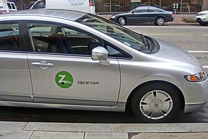
English: Zip car carsharing service at downtown Washington, D.C. (Photo credit: Wikipedia)
New Flyer C40LFR laying over ath the Federal W...
New Flyer C40LFR laying over ath the Federal Way Transit Center. It left a few minutes later on route 402. (Photo credit: Wikipedia)
Lincoln City, Oregon
Lincoln City, Oregon (Photo credit: Wikipedia)
English: Two buses at the Forest Grove, Oregon...
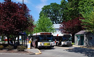
English: Two buses at the Forest Grove, Oregon terminal of TriMet, the public transit agency serving the Portland, Oregon metropolitan area. This off-street bus loop for route 57 is located at 19th Avenue and B Street in Forest Grove and is the farthest-west point in the TriMet system. Buses 2559 and 2554 are both New Flyer D40LF units built in early 2001. The small building on the right is for use by bus drivers. (Photo credit: Wikipedia)

One of the biggest challenges for those looking to do without a car is when trips need to be made beyond the normal transit area. For those that are able to drive there is the option of renting a car either through one of the car sharing companies such as Zipcar or traditional rental car companies.

However, renting a car is expensive and will most likely become even more expensive with Hertz taking over Dollar/Thrifty leaving only four major companies left to provide rental cars.

For those that cannot drive, the options are even worse as service to many areas is either non existent or very poor and not designed for inter-regional trips. For example, in the last few months I have made three trips to Tillamook from Portland. While there is limited bus service from Tillamook to Portland you cannot travel from Portland to spend the day in Tillamook. In fact even for people traveling to Portland the schedule only allows for five hours in Portland itself.

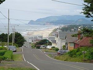
For another example let's look at Lincoln City, Oregon which is a major tourist destination. If you want to head to Lincoln City from Portland for the day forget it. There is only two transportation options. One is a casino bus that runs only a few days a week that will take you to Chinook Winds Casino on the north side of town. However, if your leaving from the Portland area it leaves the Gateway Transit Center at 5:30am. Not a very appealing time.

The only other option is the expensive Airport Caravan that travels from Yachats to the Portland Airport via Lincoln City and cost $55.00. Problem is it travels to Portland in the morning then returns in the early afternoon. Lincoln City used to have Greyhound service until a few years ago that was a little more affordable but still did not have the best times.

In Northwest Oregon/Southwest Washington we have a number of transit agencies including TriMet, Cherroits in Salem, SAM, SMART, Canby Area Transit, Woodburn Transit, C-Train, Lower Columbia, CUBS in Longview, Amtrak, Greyhound, Bolt, Sunset Transit, Tillamook County Transit, Lincoln County Transit, Pacific County Transit and several others I am probably forgetting about.

The problem is these agencies number one priority is their own service area and are often blind to travel needs beyond their districts. If we are going to create a sustainable alternatives to automobile travel, all agencies are going to need to work together to provide service that connects important points not just in their own area but regionally also.

To complicate matters even further is the fact that support for any transit service disappears once you leave the urban areas and that is why some districts such as Pierce Transit in Tacoma, WA cut back their service district recently and Intercity Transit in Olympia, WA did it several years ago. Officials made the decision that it was better to create a smaller district that would have more support but of course cuts those off who are located outside the new district.

One way to solve some of the problems would create a regional transit coordinating agency that would work with all the different agencies not only the transit providers themselves but other stakeholders to design a system that will create a more usable system. Recently Reconnecting America recently had a program that discussed issues in rural areas and how to more effectively service them. One agency in southern Maine worked with public and private companies to better coordinate transit service in the area including connecting it up with Amtrak's Downeaster service between Portland, Maine and Boston.

The difficulty in creating a regional agency is to create an organization that can walk the thin line between being able to work with all the agencies involved to coordinate activities including fares, service, and marketing while not alienating groups and not becoming another bureaucratic nightmare of an agency that exists on its own inertia.

Basically we are down to the old chicken and egg scenario. Do we worry about only providing transit service to the busiest urban areas and let the outer and rural areas deal with it until the time comes when transit service becomes more vital across the board or do we start to look at a big picture?

While I used the a section of the northwest for example, you could look to almost any area of the country and see the problems that exist we access to transit services and the lack of coordination between agencies. If transit service is to become a more important part of the transportation mix, service will need to be better coordinated to make transit service more useful to the largest number of possible riders.


Enhanced by Zemanta

Tuesday, September 04, 2012

How Economic Development affects Effective Planning

Mayor Dennis Doyle
Mayor Dennis Doyle (Photo credit: Wikipedia)

In my last couple of posts, I talked about the efforts of many cities to create economic development by inciting corporations with subsidies to locate. Today, I am going to talk about how corporations influence public policy and can have a detrimental effect on effective public planning.

I also mentioned in the first posting of last week that often times companies will relocated such as Sears Holdings moving from downtown Chicago out to the suburbs through government subsidies creating a situation where the new location is poorly accessed by transit by its poor location. Further when one set of subsidies expire the corporations will often come back demand more and threaten to move if they do not get what they want. The problem is these major national/multi-national corporations do not care about the cities and will go where they get the biggest subsidies.

Now lets take a look at how these issues can affect effective planning by using the example of Nike.

Nike is located in Washington County, Oregon near the city of Beaverton. Like many corporate campuses it was designed around the automobile and transit access is near impossible as can be seen in this Google map image:


View Larger Map

There is bus service along Murray Blvd to the east, and as you can see in the map it is relatively close to a MAX light rail station. Looking at the map you can see a forested area that extends from the south of Jenkins Road to the MAX Blue Line. This property is owned by NIKE and it was proposed that they would extended their headquarters across Jenkins to that piece of land.

However according to the urban plan because it is located at a MAX station it needed to include housing and two new roads needed to be built to better access the site. In addition the city of Beaverton tried to annex the site which affects Beaverton because the traffic created by Nike has to be solved by the city of Beaverton.

Nike responded by filing a lawsuit against the city of Beaverton to prevent the annexation so that they would not face paying higher city taxes. This shows another problem with these relocations (while NIKE was not relocated it provides a good example), that a company will get subsidies to move outside city limits so they pay less in taxes but the nearby cities often end up subsidizing the roads in order to get the workers to the new building.

In addition NIKE started lobbying state senators and legislatures to help solve their problem for them and Charley Ringo a State Senator from Washington County was more than happy to obliged fearing that NIKE would pull up states and leave and despite being a member of the Sierra Club drafted legislation that forbid the city of Beaverton to annex the area for 50 years. That's right for two generations nothing can be done to enforce the plan that was previously created to make the area more transit friendly and ensure that Transit Oriented Development is put in by the MAX station.

In addition after the legislature of the state of Oregon dictated what the city could do for the next 50 years, NIKE tried to influence the next election for Beaverton mayor by donating and promoting heavily the person running against the current mayor who they declared was not "business friendly".

It is hard enough to get good development done, situations like this make it even harder and do nothing to build a better community. While giving subsidies to major/multi-national corporations may be a short term solution to economic development, in the long run working to build a local economy that has a stake in the community does more than throwing millions out the door.

I am not saying NIKE is a bad company, however they are looking at their own self interest. The people that should have been looking out for the best interest of the community such as State Senator Charley Ringo who interesting enough did not run for reelection the following year should have considered not only what NIKE wanted by what was in the long term best interest of the community as a whole.
Enhanced by Zemanta

Tuesday, August 28, 2012

New Hillsboro Stadium

English: Hillsboro Stadium in Hillsboro, Oregon
English: Hillsboro Stadium in Hillsboro, Oregon (Photo credit: Wikipedia)

In my last posting I talked about sports stadiums when specifically talking about economic development and how they don't actually accomplish what they set out to do. Today I am going to focus on the new Hillsboro stadium which next year will be home to the Hillsboro _________ baseball team that is currently the Yakima Bears.

As I mentioned in my last posting, you often here how wonderful these new stadiums are, how they will attract so much spending and will benefit the whole city. If you read Paul Allen's autobiography you will get a very good one sided opinion on the importance of the new stadium that was built in Seattle. The one good point about the new Seattle stadiums is that they are located near downtown will good transit access. The question is, what is their true cost?

Now lets take a look at the recently approved stadium in Hillsboro which will be built near Evergreen Drive and 229th. The stadium is located near the US Highway 26 but is two miles from the nearest MAX station and located near one of TriMet's weaker all day lines the 47 which after next week will take over the weakest portion of route 89 and travel from the Sunset Transit Center to Hillsboro. The route only runs Monday through Friday with limited evening service.

That means that access the new stadium via transit is a non-starter unless you want to walk two miles along roads that are design to speed drivers and not designed to make it a pleasant walk. I have walked some of the streets in the area and can tell you they are not designed with the pedestrian in mind. Now compare that to the Salt Lake Bee's stadium that is located just one short block from the TRAX light rail station on 1300 South in Salt Lake City, which one would your rather access:

Hillsboro:


View Larger Map

Salt Lake City:


View Larger Map

We can basically assume that most people are going to drive to the new stadium since transit is a non-starter. To make matters worse most of the weekday games will probably be in the evenings when the most number of people will attend so that means that it will make traffic conditions along US Highway 26 even worse with no alternatives to being stuck in traffic.

Then there is the financing of the stadium. The city of Hillsboro will finance the cost of the stadium by issuing a bond. Supposedly the bond will be repaid through ticket sales and naming rights through the stadium. However, the city is already stated that they will probably not be enough to repay the bond so the taxpayers will be on the hook.

Then we have the issue of the so called "multiplier affect". There is some typical chain fast food places located to the east of the new stadium along with a Fred Meyer big box store. Most of the other sit down restaurants are located a distance from the new stadium site. Beyond that most of the area is devoted primarily industrial which will be unwelcoming to those heading for the games.

How many dollars will be lost to other businesses is unknown and would most likely be felt outside the Hillsboro area although the movie theater in Hillsboro may see an affect.

When the debate was going on in Salt Lake City for a new soccer stadium that was finally put on the backs of tourist who will never probably use the facility, one long time Salt Lake talk show host Doug Wright who is also a major sports nut said that investments like these are important to the community. Of course I have shown that those dollars have to come from somewhere and often it is from businesses not located near the facility. So what is the answer?

Related articles
Enhanced by Zemanta