UTA and local citizens have proposed a streetcar running along the old railroad right of way south of 2100 South. While that would be a good start it should actually be part of a much larger system.
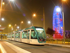
This photo is of a street car in Barcelona, Spain. Streetcars have proven popular in many places.
Streetcars were proposed in several places including along South Temple but it looks like UTA and the Wasatch Front Regional Council are backing off and trying to substitute BRT.
Here is one proposal to make the Sugar House Trolley a vital resource. Start at the Intermodal Station and follow TRAX to Main and South Temple using all the TRAX stops. They are close enough together in Downtown to work. Then continue down South Temple all the way to 1300 East.
Then 1300 East to 200 South to University Street then down to meet TRAX. In this section with proper planning with the U of U you could create a nice transit corridor with the streetcar running on its own right of way on the east side of the street and University down to two lanes for cars. It would then use the Stadium TRAX station and head onto 500 South.
From there it would turn on 1300 East and head south allow it to serve Westminster. Then it would turn into the Sugar House Shopping Center and hook up with the old RR right of way.
From there it would travel to the 2100 South TRAX station. From there it would travel along TRAX to the 1300 South Station. At the present time there is little reason to run it in the streets since 300 West is composed of sprawl centers not conducive to the streetcar.
Once it leaves the Ballpark TRAX station it would continue on the old UP right of way that leaves the current TRAX line just north of the station and make its way over to 400 West.
It would continue on 400 West to 200 South and then back to the Intermodal Hub.
Consider what this line would serve: the Intermodal Hub, Gateway, LDS Business College, BYU Salt Lake Center, City Creek, Temple Square, the University of Utah, Westminster, Sugerhouse Square and make multiple connections with TRAX.
This could be the springboard to bringing in more streetcars and develop more walkable communities.
Thank you to So Cal Metro who took this picture.
1 comment:
I used to have to waste a ton of time trying to get all the different website
for a trip pulled together. I found
publicroutes.com a great tool that really gives transit directions and
maps. On top of that they have driving directions if no buses go that way and
there driving directions are amazing. Unlike
href="http://www.mapquest.com"> mapquest they provide both driving and
transit.
free transit directions
On top of that they provide a tool for websites to provide
href="http://www.publicroutes.com/webtools/freelinkdirection.aspx"> free
transit directions to their business. This means that now everyone can
encourage people to use public transit to get to their store.
The other really great thing is that directions can be sent straight to your
cell phone so I do not have to write them down.
accuracy
Of course all this said, it is not perfect and accuracy is a work in
progress. However, it is public transit and I have found them to be as
acccurate as most city transit systems.
vacation
The best part is that when I am visting a city on vacation I can use
publicroutes to get transit directions around the city. How cool is that?
They also are developing a point of interest page making finding cool places
even easier.
I would love to hear what you think.
Sarah Smith
Post a Comment